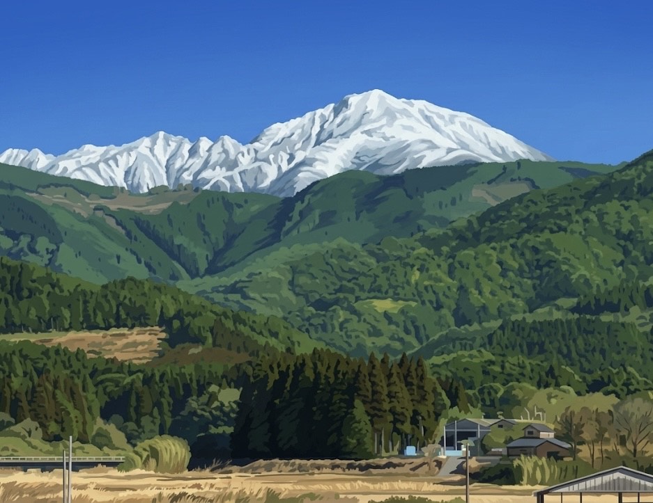
The Mountains of the Hitoyoshi Basin (人吉盆地の山々)
This picturesque illustration—with its snow-capped peaks towering over lush green hills and quiet rural farmhouses—beautifully represents the landscape of the Hitoyoshi Basin, surrounded by the steep Kyushu Mountain Range.
Here is why this geography is so vital to our region’s identity:
The Natural Fortress: The Hitoyoshi-Kuma region is entirely enclosed by deep mountains. This geographical isolation acted as a natural fortress. It is the very reason why the Sagara clan was able to rule this area undisturbed for an astonishing 700 years, allowing unique local cultures, dialects, and architectural styles to be perfectly preserved.
Mount Ichifusa (市房山): The prominent, towering mountain in the background is Mt. Ichifusa, which sits on the eastern edge of the basin. Standing at 1,723 meters, it is the highest peak in the area and is revered as a sacred mountain by locals. In winter, seeing the majestic snow-capped peaks contrasting with the valley below is a beloved local sight.
The Mother of the River and Fog: These dense mountain forests act as a giant natural sponge, capturing rain and snow. This water filters underground and eventually flows into the Kuma River. This pure water is the lifeblood of our famous Kuma Shochu and local rice farming.
Furthermore, the basin’s geography creates extreme temperature differences, giving birth to the thick, mystical morning fog that the region is famous for.
It is exactly this kind of serene, untouched mountain scenery that makes visitors feel as though they have stepped into the magical world of Natsume’s Book of Friends.
コメント